DAY WALK TO SOUTH-EAST CAPE, TASMANIA©
TONY & MATTHEW WATTON
MONDAY 14/2/2011
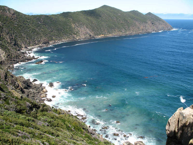
South-East Cape from South Cape Bay
Background
Maybe six years ago I set out by myself to see how far along the foreshore I could walk towards South-East Cape. It was only a day walk so I carried a light pack with a few emergency supplies. The conditions on the shore were quite reasonable, with no waves breaking high enough to cause me any undue concerns. That is, until I reached a long, wide channel running up to the rock cliff-face. Here the waves were funnelling in and breaking wildly - enough to encourage me to look in awe at what was an impassable barrier. I walked back to Cockle Creek. However, every time I have stood at the shore of South Cape Bay since then I have looked across towards the east with an intention to one day walk out there.
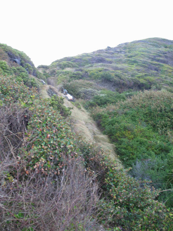
Matthew and I had previously attempted to walk to South-East Cape in November 2006, intending to camp near the end of the Cape and walk back the following day. On this particular day we intended to follow a track up from the water, through a small campsite, in fairly dense scrub. We followed a marked track that meandered steeply up and down, making progress difficult. To add to the relative discomfort, on the walk over the rocky part of the track to the coast I had tripped and fallen forward, with my right knee striking a flat rock in front of me. This caused some pain and became progressively worse, swelling up as we continued on our way.
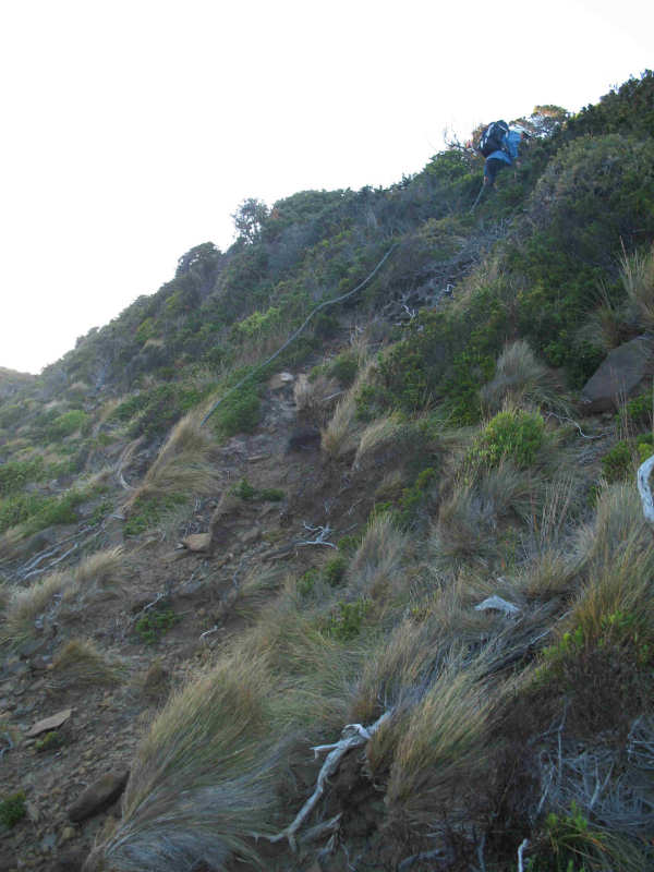
The track we followed through the scrub was indistinct in parts, quickly draining our energy levels (mine in particular). It became apparent to me, by the time we reached the fixed rope that assists in climbing a particularly steep section, that it would not be sensible to continue the walk. We descended to the coast via a creek bed and carefully made our way back to the main South Coast Track and from there to Cockle Creek.
Our Walk on Monday 14/2/11
Matthew arrived at my home by 2.30 am and five minutes later we were on our way to Cockle Creek for a very long day out. The drive to Cockle Creek was easy - virtually no traffic as one might expect at that time! - but a highlight for us both was to see, on the gravel road past Ida Bay, a Black Eastern Quoll in the car's headlights and a short time later a juvenile Tasmanian Devil. I slowed the car almost to a stop to allow them time to escape at the side of the road. There were also a few Pademelons at different times of the trip around this area.
We arrived at Cockle Creek at 4.30 am, got our boots on and, just on 5.00 am, set off along the South Coast Track in cool conditions, using our head torches to light the way. I mentioned to Matthew that, although we would not expect to see anybody on this part of the walk, it might be very different when walking back along the same track later in the day, being a public holiday, with temperatures in the low 20os.
On arriving at the coast just after 7.00 am we passed close to a small campsite that was occupied by a tent. We were disappointed to see the campers had lit an illegal fire close to the tent on the peat soil, despite the presence of 'No Fires' signage at the registration shelter at the start of the walk. The fire didn't appear to be alight, but we could still smell smouldering coming from somewhere.
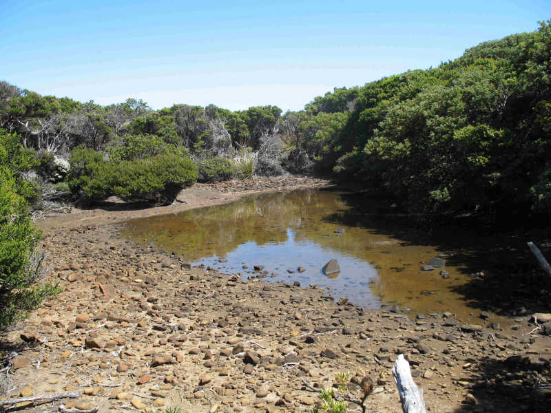
We found an easy route down from the cliff-top to the shore, clambered down a gully, and glanced back to ensure we would find the route on the way back.
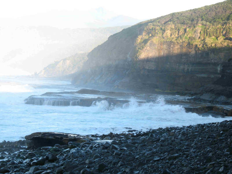
For this walk I had checked the Bureau of Meteorology's website and read that high tide for Recherche Bay was to be at 3.59 am and low tide at 11.43 am. Both were acceptable forecasts and at the shore we were pleased to see that conditions were fairly mild, with an outgoing tide and a swell of about 1.5 metres. Even so, we kept high on the rocky foreshore and took great care when crossing the rock platforms, where the sea washed across them.
After about 30 minutes we came to the creek gully and were happy to see a rock cairn marking the route up from the shore. We were, however, disgusted at the amount of plastic garbage that had been washed up onto the shore from, one can only assume, the many fishing boats that cross South Cape Bay. I'm afraid I don't believe the excuse that the stuff gets accidentally washed over the side of fishing boats. There is simply too much rubbish for that to be believable. This is a problem that occurs along the entire south and west coasts of Tasmania - as Matthew has experienced on his three circumnavigations of Tasmania, and others, by sea kayak (see his trip reports at mwatton.blogspot.com.au ).
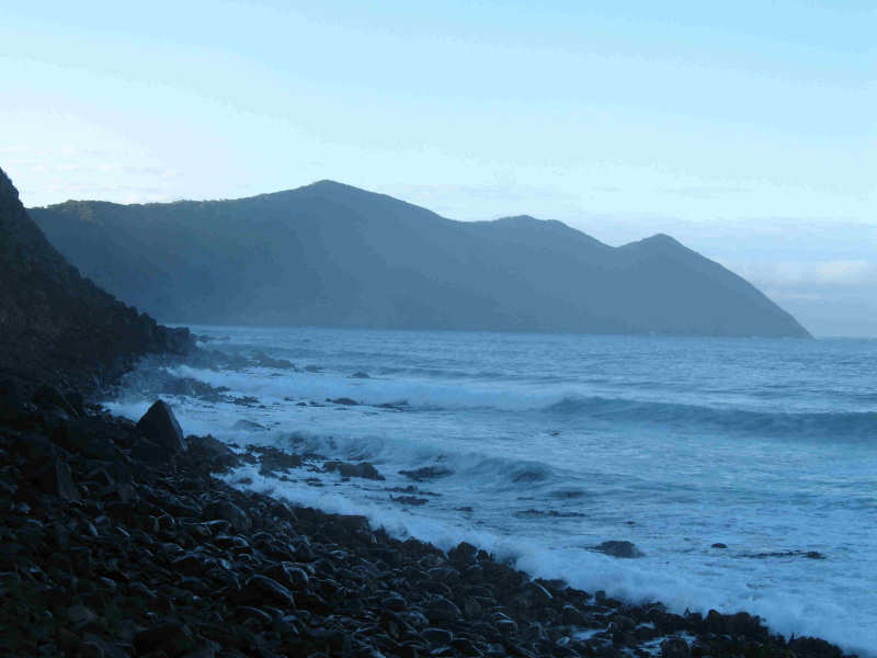
We were soon walking on the track to South-East Cape, generally following the ridge-line and sometimes walking close to the edge of the cliffs overlooking South Cape Bay. At these times the extent of the walk that was ahead of us was evident, with the undulations over the Three Hillocks still beckoning. There were spectacular views along the south coast and far out to sea in front of us.
It soon became clear that this track is seldom used as the scrub was very thick at times. For example, there were occasions when we were pushing through head-high bracken fern, unable to see where we were placing our footsteps - hopefully avoiding the snakes we assumed lay before us. I mentioned to Matthew that I thought this was prime tick country. [Since finishing the walk Matthew found one of the little darlings clinging to a leg. I think he got it off!]
We passed a small pond that could have been used as an acceptable water supply in an emergency (probably using sterilising tablets for safety). This was the only water apart from dripping water from the cliffs and the small creek that we ascended from the shore earlier. Matthew saw what was probably a tiger snake, about 1.5 metres long slither away off to his right. I heard it moving but did not see that one.
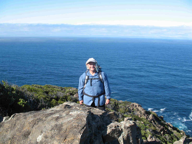

The track twisted and turned often but eventually we "turned the corner" and actually started to make some progress in a south-westerly direction along the peninsula. The track essentially followed the ridge across the hillocks and at each summit I expected to be at the end, only to be met by another of the hillocks. Finally of course we did reach the rocky descent to the very end of the Cape, stopping about 30 metres from the sea at about 10.00 am. We sat and looked in awe at the sea on three sides of us with virtually nothing in front, apart from two fishing boats laying nets a few hundred metres away. The rock around us seemed to have a crumbly texture, with some rocks having holes completely through them. According to Ken Collins in "South-West Tasmania" (p276) South-East Cape consists of "Jurassic dolerite, the most southerly point on Australia; hard-rock cliffs".
In the far distance (about 26 kms in a south-south-easterly direction) Matthew identified Pedra Branca Rock. We saw, even at that distance, waves breaking on the westerly side - they must have been awe-inspiring up close.
On the far western horizon we saw Maatsuyker Island and, to the south of that, Mewstone Rock. It was the first time that I had been able to look back into South Cape Bay. Matthew, however, was not as excited because he had seen this view from sea level on many previous occasions.
At around 10.45 am we retraced our steps back up to our packs. Matthew was in front. We had made the mistake of putting our packs down between two rocks and if it had not been for the fact that Matthew had put his drink bottle of Fierce Berry Gatorade on top of his pack we would have completely missed seeing them. I imagined possibly a flock of forest ravens had conspired to attach vines to the packs and flown away with them - they're that smart!!
An early lunch - peanut butter sandwich and Gatorade and a few biscuits that Matthew had brought - then we set off on the return journey. This was relatively uneventful except for my weariness that required a couple of rest breaks with drinks of Gatorade to replenish electrolytes etc. When we had descended the creek onto the rocky shore Matthew unexpectedly produced two mini bottles of Coke - not something I normally drink but very welcome and refreshing.
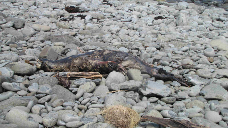
By this time the tide had gone out, exposing the rock platforms, which we were able to walk across quite safely. At one point on the rocky shore we were assaulted by a disgusting stench of decaying flesh. Matthew pointed out a 2+ metre long dead seal in an advanced state of decomposition. To me it looked like a small leopard seal, judging by the fearsome teeth. However, Matthew thought it might be a more common Australian fur seal as all seals have teeth, being meat-eaters. It was a wonder we had not encountered it on the walk past it earlier in the day. I assumed the breeze was previously blowing offshore, protecting us from the smell.
Around 1.45 pm we arrived back at South Coast Track where we saw the first of many day-trippers and school groups who were enjoying the beautiful summer day at the coast. We stayed for about 15 minutes then started the two-hour walk back to the car at Cockle Creek. Our feet were starting to burn (stinging sensation) by this stage, having walked almost non-stop since 5.00 am. We estimated that, with a few rest stops on the way, we should finish by about 4.30 pm.
As things turned out, we must have made better progress that we expected because we finished at just on 4.00 pm - very happy with our day's work and pleased to have finally visited the southernmost point in Australia that one can walk to.
The car trip back to civilisation was uneventful and relaxed, no rush but taking care in our tired condition.